 |
 |
 |
 |
 |
 |
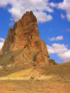
| Agathla
Peak, (skyline) and other
volcanic necks near Kayenta, Arizona |
Zoom on
Agathla Peak in northern Arizona. It
is a volcanic neck |
Volcanic neck near Kayenta, Arizona |
Volcanic necks near Kayenta, Arizona |
Agathla Peak, (skyline) and
other volcanic necks near Kayenta,
Arizona |
Volcanic neck near Kayenta, Arizona |
 |
 |
 |
 |
 |
 |
| Shiprock, a
volcanic neck in NW New Mexico. |
Shiprock in
New Mexico, a volcanic neck. |
Shiprock,
in New Mexico, with the dike on the
left side |
Shiprock in
New Mexico, with dike system to the
left. |
A volcanic
neck in the Shiprock Volcanic Field,
New Mexico. |
Church Rock
in eastern Arizona near Shiprock. |
 |
 |
 |
 |
 |
 |
| Church Rock
in Arizona, with Agathla Peak in the
far distance |
Church Rock
in Arizona, a volcanic neck in the
Shiprock Volcanic Field |
Agathla
Peak, a volcanic neck on the Navajo
Reservation near the north Arizona
border. |
Agathla Peak
rises almost 1,500 feet above the
surrounding plains. It is about 27
million years old |
Zoom on
Agathla Peak in northern Arizona. It
is a volcanic neck |
Agathla
Peak, a volcanic neck in northern
Arizona |
 |
 |
 |
 |
 |
%20with%20lines_small.jpg) |
| A volcanic
neck in the Shiprock Volcanic Field,
New Mexico. |
A volcanic
neck in the Shiprock Volcanic Field,
New Mexico. |
Jackson
Butte, a Tertiary volcanic neck in
the California Mother Lode near
Jackson |
Jackson
Butte, a Tertiary volcanic neck in
the California Mother Lode near
Jackson |
Stanislaus
Table Mountain, a classic inverted
stream near Jamestown in the
California Mother Lode |
Stanislaus
Table Mountain, a classic inverted
stream near Jamestown in the
California Mother Lode |
%20b_small.jpg) |
 |
 |
 |
%20b_small.jpg) |
%20b_small.jpg) |
| Stanislaus
Table Mountain, a classic inverted
stream near Jamestown in the
California Mother Lode |
Stanislaus
Table Mountain, a classic inverted
stream near Jamestown in the
California Mother Lode |
Stanislaus
Table Mountain, a classic inverted
stream near Jamestown in the
California Mother Lode |
Stanislaus
Table Mountain, a classic inverted
stream near Jamestown in the
California Mother Lode |
Stanislaus
Table Mountain, a classic inverted
stream near Jamestown in the
California Mother Lode |
Stanislaus
Table Mountain, a classic inverted
stream near Jamestown in the
California Mother Lode |
 |
 |
 |
 |
 |
 |
| The
Pinnacles composite cone, a deeply
eroded volcano at Pinnacles National
Monument |
Distant view
of the High Peaks of Pinnacles
National Monument, a deeply eroded
composite cone. |
Distant
view of the High Peaks of Pinnacles
National Monument, a deeply eroded
composite cone. Eroded rhyolite in
foreground |
Distant view
of the High Peaks of Pinnacles
National Monument, a deeply eroded
composite cone. Eroded rhyolite in
foreground |
At Pinnacles
National Monument, Bear Creek cuts
through the heart of a deeply eroded
composite cone |
High Peaks
section of Pinnacles National
Monument, a deeply eroded composite
volcano |
 |
 |
 |
 |
 |
 |
| Eroded
rhyolite breccia at Pinnacles
National Monument. The tilt is
original slope of the deposit |
View from
the High Peaks Trail at Pinnacles
National Monument. Eroded rhyolite
breccias |
View from
the High Peaks Trail at Pinnacles
National Monument. Eroded rhyolite
breccias |
High Peaks
from the Condor Gulch Trail at
Pinnacles National Monument, a
deeply eroded composite cone |
Rock spire
on Condor Gulch Trail at Pinnacles
National Monument |
Eroded
rhyolite breccia at Pinnacles
National Monument. |

