|
Images of Mount Shasta,
California |
|
Standing at 14,163 feet, Mt. Shasta
is the second highest Cascade
volcano, and the most voluminous. It
is also the second most active cone
in the range, after Mt. St. Helens,
having last erupted in 1786 and with
eruptive activity averaging once
every 600 years or so. It is a true
composite cone, being made up of at
least four distinct volcanoes:
Sargents Ridge, Misery Hill,
Shastina and Hotlum Cone (the
youngest). Around 300,000 years ago,
a gigantic debris avalanche swept
off the north side of Shasta and
traveled 28 miles to the location of
the town of Yreka. |
| |
|
|
|
|
|
 |
 |
 |
 |
 |
 |
| Mt. Shasta
from the east, taken from Little Mt.
Hoffman |
Mt. Shasta
from the east, taken from Little Mt.
Hoffman |
Mt. Shasta
from the east, taken from Little Mt.
Hoffman |
Mt. Shasta
and Shastina from the southwest,
from Castle Crags State Park |
Mt. Shasta
from the southwest, from Castle
Crags State Park |
Misery Hill
and Sargents Ridge cones, two of the
older "Mt Shastas" |
 |
 |
 |
 |
 |
 |
| Misery Hill,
and the Red Banks, one of the most
recent eruptions |
Shasta and
Shastina from the northwest |
Shasta and
Shastina from the northwest |
Bolam (left)
and Whitney glacier (California's
largest) on north flank of Shasta |
Shasta from
the north. Shastina on right |
Shasta from
the north side |
 |
 |
 |
 |
 |
 |
| Shasta from
the southeast on Medicine Lake
Highland Road |
Shasta from
the southeast on Medicine Lake
Highland Road |
Shasta from
the southeast on Medicine Lake
Highland Road |
Shasta from
high on the south flank, at Bunny
Flats trailhead |
Shasta from
high on the south flank, at Bunny
Flats trailhead |
The Sargents
Ridge cone, one of the oldest former
Mt Shastas |
 |
 |
 |
 |
 |
 |
| Shasta from
Interstate 5, Shastina in the
foreground |
Shasta from
Interstate 5 near Yreka (north).
Giant landslide deposit in
foreground |
Shasta from
Bunny Flats in June |
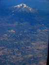
Aerial of
Shasta from the east |
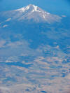
Aerial of
Shasta from the east |
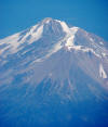
Aerial of
Shasta from the east |
 |
 |
 |
 |
 |
 |
| Aerial view
of Mt. Shasta with hummocky
topography of giant debris avalanche |
Aerial view
of Mt. Shasta with hummocky
topography of giant debris avalanche |
Aerial view
of Mt. Shasta with Shastina in
foreground |
Aerial view
of Mt. Shasta and Whitney Glacier
with Shastina in foreground |
Shasta from
the northwest, aerial view |
Aerial view
of Mt. Shasta with hummocky
topography of giant debris avalanche |
|
|

