|
Images of Mauna Kea - The Capping
Stage (Click on
thumbnails to see full images) |
Mauna Loa and Mauna Kea can be
considered twins in that they are
both very tall shields (almost
14,000 feet), but they are also very
different. The somewhat older and
less active Mauna Kea is steeper and
has a much more irregular outline.
In the capping stage,
the smooth original shield and
caldera have been covered with
tephra, basalt flows, and cinder
cones. Mauna Kea has not erupted in
some 5,000 years, and the summit is
dotted with very expensive
observatories. The
Onizuka Center for International
Astronomy has a Visitor
Information Station at the 9,300
foot level of the mountain that
provides nightly telescope
observations of the cosmos free to
the public. |
 |
 |
 |
 |
 |
 |
| Mauna Kea
from Pu'u Huluhulu near the summit
of Saddle Road |
Aerial of
Mauna Kea from the east on approach
to Hilo |
Aerial of
Mauna Kea from the east on approach
to Hilo |
Aerial of
Mauna Kea from the southeast on
approach to Hilo |
Complex of
the Onizuka Center for International
Complex on south flank of Mauna Kea,
Mauna Lea in distance |
Mauna Kea
from Saddle Road summit junction |
 |
 |
 |
 |
 |
 |
| Mauna Kea
from Pu'u Huluhulu near the summit
of Saddle Road |
Mauna Kea at
Saddle Road summit. 1935 lava flow
from Mauna Loa |
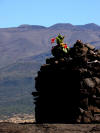
Offering at
Mauna Kea |
Shadow of
Mauna Kea on eastern horizon from
above (Onizuka Center) |
Observatories on summit of Mauna Kea |
Mauna Kea
from Hilo Bay, Coconut Island in
foreground |
 |
 |
|
|
|
|
| Mauna Kea
from the Kona Coast area |
Mauna Kea
from the Waimea area |
|
|
|
|
| |
|
|
|
|
|
|
Erosional Stage and Rejuvenation-
Haleakala, West Maui and Kaua'i |
The other Hawaiian Islands are no
longer on the hot spot that
generates magmas like those at
Kilauea and Mauna Loa. The volcanoes
of Maui, Oahu, Kaua'i and the other
islands have become mostly inactive
and their edifices have started to
erode in the moist, warm tropical
conditions (the erosional
stage). Before the
volcanoes completely disappear, they
often display a last burst of
activity, producing cinder cones,
tephra, and lava flows that cover
parts of the older shields, the
so-called rejuvenation stage.
Eventually, erosion and subsidence
win out and the islands sink beneath
the waves. Former Hawaiian islands
dot the sea floor in a line all the
way to the Aleutian Islands. Here
are some examples from Maui and
Kaua'i....
|
Haleakala on Maui:
Haleakala rises to over 10,000 feet
above sea level and mostly retains
the original shield shape, but
erosion cut deeply across the
volcano forming gorges nearly as
deep as the Grand Canyon. Subsequent
eruptions have largely filled the
valleys forming a huge crater-like
valley below the summit.
|
 |
 |
 |
 |
 |
 |
| Haleakala
and coastal town of Kihei |
Aerial view
of Haleakala looking east. Sugarcane
fields in foreground |
Aerial view
of Haleakala looking east. Sugarcane
fields in foreground |
Summit
valley of Haleakala with cinder
cones of the rejuvenated stage |
Summit
valley of Haleakala with cinder
cones of the rejuvenated stage |
Summit
valley of Haleakala with cinder
cones of the rejuvenated stage |
 |
 |
 |
 |
 |
 |
| Valley wall
of Haleakala summit |
Haleakala
summit valley |
West wall
of Haleakala summit and Ko'olau Gap |
West wall of
Haleakala summit and Ko'olau Gap |
Looking west
from Haleakala summit area |
Southwest
rift valley of Haleakala,
Mauna Kea in distance |
 |
 |
 |
 |
 |
 |
| Mauna Kea
and Mauna Loa from Haleakala Summit |
Sunrise from
summit of Haleakala |
The
Geotripper Logo - daybreak from
Haleakala |
Cloud layers
at sunrise from summit of Haleakala |
Morning
shadow of Haleakala on horizon |
Ko'olau Gap
from summit of Haleakala |
 |
 |
 |
 |
 |
 |
| Summit
valley of Haleakala with Mauna Kea
and Mauna Loa in distance |
Summit
valley of Haleakala with cinder
cones from the rejuvenation stage |
Sunrise
from Haleakala |
Sunrise from
Haleakala |
Summit
valley of Haleakala and cinder
cones |
Summit
valley of Haleakala |
| |
|
|
|
|
|
|
West
Maui Volcano: Making up the
western side of Maui, the West Maui
volcano is barely half the height of
Haleakala, and is essentially
extinct. It is deeply eroded,
especially in the center where the
central crater has been eroded out
at 'Iao Valley. The summit receives
in excess of 300 inches of rain each
year. |
 |
 |
 |
 |
 |
 |
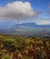
| West Maui
volcano from the slopes of Haleakala |
West Maui
volcano from the slopes of Haleakala |
Waikapu
Canyon on the east side of the West
Maui volcano |
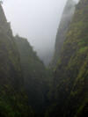
Valley
wall of Pu'u Kukui Crater at 'Iao
Valley |
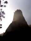
'Iao Needle
(eroded dike on left) and valley
wall at Pu' Kukui Crater at 'Iao
Valley |
Valley wall
of Pu'u Kukui Crater in 'Iao Valley |
 |
 |
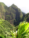 |
 |
 |
 |
| Looking
downstream from 'Iao Valley to
coastal plain |
'Iao Needle,
an eroded dike in the Pu'u Kukui
crater. Hawaiians call it Kuka
'emoku |
East wall
of 'Iao Valley, the Pu'u Kukui
crater of West Maui volcano |
'Iao Needle,
an eroded dike in the Pu'u Kukui
crater. Hawaiians call it Kuka 'emoku |
Looking up
the 'Iao Valley into interior of
Pu'u Kukui |
'Iao Needle,
an eroded dike in the Pu'u Kukui
crater. Hawaiians call it Kuka 'emoku |
| |
|
|
|
|
|
|
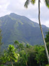
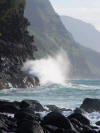
Kaua'i: The oldest
of the main islands and the most
eroded. Unlike the other islands,
Kaua'i is essentially a single
volcano, albeit a complicated one.
Of the complications, a fault zone,
led to the creation of one of the
most scenic wonders of the islands,
Waimea Canyon. Giant landslides have
produced the spectacular cliffs of
the Na Pali. |
 |
 |
 |
 |
 |
 |
| Old shield
basalts on southeast coastline of
Kaua'i at Nawiliwili |
Hanalei
Valley on north side of Kaua'i, a
deeply eroded shield volcano |
Hanalei Bay
waterfalls on Kaua'i, a deeply
eroded shield volcano |
Na Pali
cliffs on north shore of Kaua'i, a
deeply eroded shield and landslide
scarp |
Waterfall in
Waimea Canyon, Kaua'i, a deeply
eroded basalt shield |
Kipu Kai
Coastline on southeast side of
Kaua'i |
 |
 |
 |
 |
 |
 |
| Waimea
Canyon on Kaua'i, showing slope of
original shield |
Na Pali
cliffs on Kaua'i, a deeply eroded
shield volcano |
Lower
Waimea Canyon, showing eroded
basalts and the general slope of the
original shield |
Na Pali
cliffs overlook at Kaua'i, a deeply
eroded basaltic shield |
The Na Pali
coast, the scarp of an immense
landslide and a deeply eroded shield |
The Na Pali
coast, the scarp of an immense
landslide and a deeply eroded shield |
 |
 |
 |
 |
 |
 |
| The Na Pali
coast, the scarp of an immense
landslide and a deeply eroded shield |
Lower Waimea
Canyon, showing eroded basalts and
the general slope of the original
shield |
The
Waialeale Plateau, the slope of the
original volcano and the Alaka'i
Swamp, the wettest place on Earth |
The Alaka'i
Swamp on Mt. Waialeale, the wettest
place on Earth |
Kilohana
Lookout and Hanalei Bay at Kaua'i, a
deeply eroded shield volcano |
Waihina
River Canyon from Kilohana Lookout,
showing deeply eroded shield basalts |
| |
|
back to
Hawaiian Shield
Building Stage |
|
back to the
Volcanoes Page |
| |
|
|
|
|
|

