 |
 |
|
This page is being transferred from http://virtual.yosemite.cc.ca.us/ghayes/roadside.htm, and has been revised and updated, including many more photographs. Enjoy! Some links may not be active yet. If they are, use the "back" button to return to this page
Yosemite Valley from Wawona Tunnel Overlook (see mile 8.1) Yosemite National Park Geology: Arch Rock to Big Oak Flat Entrance (40.2 miles, 64.7 km) Objectives: The foremost objective of this trip is to introduce (or reintroduce) you to a Yosemite Valley and National Park that has been changed by a series of geological events and natural disasters in the 1990’s, including a 100-year flood, wildfires, and several massive rockfalls. This guidebook is part of more comprehensive field trip conducted by the Far West Section of the National Association of Geoscience Teachers on September 19, 1998. The route begins at the Arch Rock Entrance Station, and includes a circuit of Yosemite Valley and an exploration of the Big Oak Flat Highway which we will follow to exit the park. On this trip we can study the batholithic rocks of the park (See the geologic map of Yosemite Valley), and the erosional work of glaciers, rivers, and mass wasting. For background on the glaciations that have affected the Yosemite Valley region, click here. For background on the granitic and plutonic rocks of the Yosemite Valley region, click here. For a geologic map of the Yosemite Valley area, Geologic Map of Yosemite Valley. ALL SMALL PICTURES ARE THUMBNAILS: CLICK ON THEM FOR THE FULL IMAGE! 0.0 miles
Set Odometer. As we leave the Arch Rock Entrance Station, the eastbound lane passes beneath two huge blocks of the granodiorite of Arch Rock, which have tumbled from the cliffs above. The granodiorite of Arch Rock (116 Ma) and dark gray Bass Lake Tonalite (114 Ma) near El Portal are some of the older batholith-related plutons in the valley area (Bateman, 1992). Both units are part of the early Cretaceous Fine Gold Intrusive Suite. Older sources refer to the Bass Lake Tonalite in this area as the tonalite of the Gateway, or Gateway Tonalite (Matthes, 1930; Peck et al., 1966) 2.1
The high cliff across the river is Elephant Rock, which is composed of El Capitan Granite (102 Ma). The light colored scars on the cliff and debris on the far side of the river are part of two rockfalls, totaling nearly 50,000 m3, that took place in 1971 and the winter of 1980/1981 (Wieczorek et al., 1992). According to second-hand accounts, live trout were scooped off the road surface after the river splashed onto the highway. 2.5
1982 rockslide. Rocks on both sides of the highway are part of a 100,000 m3 rockfall which took place in April 1982. The slide closed the highway for several months, severed the sewer trunk line for Yosemite Valley, and caused the permanent closure of the old Coulterville Road which crossed the slope above highway (Wieczorek et al., 1992). The rockfall originated in jointed El Capitan Granite about 200 meters (600 ft) above the highway. A huge boulder seen in fig. 49 of Huber (1987, p. 38) was demolished by maintenance crews following the 1997 flood. Fresh exposures of El Capitan Granite in the slide debris contain numerous enclaves or xenoliths of darker mafic rock. 3.0
In the next 0.3 miles, the highway passes beneath two hanging valleys containing Wildcat and Cascade Creeks. Both include waterfalls falls cut into exposures of El Capitan Granite. A picnic area is available at Cascade Creek. Pre-Tahoe glaciers shaped this part of the gorge. Glaciers of the Tahoe and Tioga stages did not reach this far down the canyon (click on the thumbnail above for a view of Lower Cascade fall). 3.6 Yosemite Powerhouse 4.8 Junction of Highways 140 and 120. Continue straight ahead. A small dam was once present here to generate electrical power at the powerhouse just downstream. The dam was removed in 2004 to return the river to a more natural flow regime. 5.7
Cross Pohono Bridge. A gaging station (diagram above), operated by the U.S. Geological Survey, is located just upstream of the bridge (the 2nd thumbnail is a similar gage at Happy Isles). Its purpose is to calculate the Merced River’s discharge (the amount of water passing a given point in a given period of time). Measured in cubic feet per second (cfs), averages at this station have ranged from 20-30 cfs in late Fall, to 24,600 cfs, recorded during the floods in January of 1997(Albright, 1998) (Check here for current flow conditions; the site is updated every hour). 6.1
Bridalveil Meadow: This is the lowest of the meadows found in Yosemite Valley. The terminal moraine of the Tioga glaciation can be seen at the east end of the meadow (Matthes, 1930; Huber, 1987). Unlike most other Sierra canyons, the Tioga Stage glacier reached further downstream than the glacier of the Tahoe stage (Huber, 1987). The lake that occupied Yosemite Valley after most of the glacial stages had apparently been mostly filled with debris by Tioga time, but a shallow lake probably remained in the wake of the Tioga glaciers. It was quickly filled with debris and sediment. This meadow was burned in October of 1997 as part of the prescribed burn program being conducted in parts of the valley. For thousands of years, natural wildfires and intentional burnings by Native-Americans cleared the conifers from the valley floor, and over time it evolved into an open oak woodland with wide meadows and a few widely scattered conifer trees. The size of meadows in Yosemite Valley has dramatically decreased in the past century. Josiah Whitney and his crew calculated meadow area in 1866 to be 745 acres. By 1937, meadow area had dwindled to 327 acres. Today, meadows cover 65 acres, leaving only 6.8% of the original 1866 meadow area. With the advent of national park status, fires were suppressed and the shade-loving conifers flourished. The forest is now dense with young trees, and the possibility of disastrous wildfires is very real (the black and white photo shows Ahwahnee and Stoneman meadows in 1944, the others are more or less current). Few native species of grasses are found in the meadows today. The majority of meadow land was cleared, plowed, and seeded in the early 1900s to support farming practices, including a dairy farm. 6.6 Turn right towards the Wawona Tunnel parking area.
8.1
Wawona Tunnel Exit: Viewpoint and discussion of the formation of Yosemite Valley. With so many media images of the valley, and, for some a familiarity that results from living nearby, it is sometimes easy to forget what a stunning and unique place Yosemite Valley really is. Nowhere else in the world is there such a combination of vertical cliffs, high waterfalls, and huge granite domes. Few places in the world display the raw power and intensity of glaciation and mass wasting. The exposures of batholithic intrusions in three dimensions have made the Yosemite region a showplace for petrologic and structural investigations. The beauty and value of this Valley is reflected in the sheer numbers of people who visit each year, more than four million. The effect of these visitations on the 4½ square miles of the valley floor is overwhelming, and park rangers must now deal with all the urban problems of traffic, crime, and air pollution, as well as protecting park resources. From the parking lot at the exit of the Wawona Tunnel, we can look east towards many of the most famous features of Yosemite Valley (see the thumbnail sketch from Huber, 1987 above for place names). On the left side is the imposing cliff of El Capitan (2,330 m; 7569 ft, 1st thumbnail ), with a sheer drop of nearly 950 meters (3,000 ft). In the center distance is the hulking mass of Half Dome (2,720 m; 8,842 ft) and Clouds Rest (3,055 m; 9,926 ft, 2nd thumbnail photo). On the right is the high spire of Sentinel Rock (2,165 m; 7,038 ft, 3rd thumbnail), rounded Sentinel Dome (2,498 m; 8,117 ft, 4th thumbnail), and the three Cathedral Rocks (1,726 m, 5,610 ft; 2,015m, 6551 ft; and 2,042m, 6,638 ft), with the wispy spray of Bridalveil Falls (189 m; 620 ft, 5th thumbnail) in the right foreground. Immediately to the north are the unspectacular slopes of the Rockslides (see the 6th thumbnail above). This spectacular scenery is so often described as a "classic" case of glacial erosion that the uniqueness of Yosemite Valley is sometimes obscured. The valley actually looks less glacially "fresh" than its counterparts in places like Hetch Hetchy Canyon on the Tuolumne River, or even Little Yosemite Valley above Nevada and Vernal Falls (Huber, 1991). Ice did fill the canyon to near the rim during the Sherwin (Pre-Tahoe) stage, and a great deal of erosion took place at that time, but Tahoe and Tioga stage glaciers barely reached the west end of the valley. Their effect on the shape of the canyon walls and cliffs was negligible. Much of the shape of the valley, including many of the recesses and alcoves, can be attributed instead to jointing, exfoliation and mass wasting. It is also immediately evident that Yosemite Valley is not a typical U-shaped valley that normally results from glacial erosion. Vertical valley walls give way to a nearly flat valley floor. The flatness itself is a clue that a lake once covered the valley floor. Evidence of the lake has also been found in the form of geophysical measurements indicating as much as 600 meters (2,000 ft) of sedimentary fill in parts of the valley, and well logs that reveal sediments to a depth of at least 300 meters (1,000 ft) (Wahrhaftig, 1962). The lake basin was carved and then filled by the larger pre-Tahoe glaciers that sculpted the valley, but a shallow lake was probably impounded by the moraines near Bridalveil Falls following the retreat of the Tioga stage glaciers just over 10,000 years ago (see the classical sequence in the thumbnails below: Pre-glacial Yosemite, Pre-Tahoe glaciation, Tahoe or Tioga glaciation and Lake Yosemite).
The rockslides (5th thumbnail above) just north of the parking area and the adjacent cliff of El Capitan clearly illustrate the influence of jointing on the shape of the valley walls. The diorite of the Rockslides forming the gentle talus slopes has closely spaced joints, while the vertical cliffs of El Capitan are composed mostly of relatively unjointed El Capitan granite (Wahrhaftig, 1962). Much of the development on the flat valley floor is hidden from view by a thick growth of young conifer trees, but the constant noise and din of tourists, buses and cars at this parking lot can be distracting. If one finds the noise and crowds here disconcerting, a steep but worthwhile hike up to Inspiration Point begins just across the highway on the right. Return to Valley Floor. 9.6
Bridalveil Falls Parking Lot: (Restrooms available) Bridalveil Falls (189 m; 620 ft) is a classic example of a hanging valley, even though it has been a long time since glaciers scoured its cliffs. Much of the sculpting of the recessed alcove occupied by the falls is the result of spalling from vertical joints in the more than 750,000 years since the Sherwin (pre-Tahoe) glaciation (Huber, 1991). Three kinds of plutonic rocks can be seen in the cliffs here. Bridalveil Granodiorite composes the lip of the falls; dikes of the Leaning Tower Granite (correlated to Illilouette Creek Granodiorite) can be seen underneath the lip of the falls and to the right (the overhanging cliff is the Leaning Tower, 2nd and 3rd thumbnails below); and the darker diorite of the Rockslides is visible to the left (Calkins, 1985). 10.0
Bridalveil Moraine: The road cuts through a Tioga recessional moraine (1st thumbnail) revealing boulders of Cathedral Peak Granodiorite as much as 2.4 meters (8 ft) across (Peck et al., 1966). In spring and early summer, Ribbon Falls (4th thumbnail above) can be seen to the left of El Capitan. At 492 meters (1,612 ft), it is the highest unbroken fall in Yosemite Valley. It is actually in a deep recess that is not always obvious (see the 5th thumbnail). 12.9
Four Mile Trailhead: View of Yosemite Falls on left (click on the thumbnails above for a look at the falls through the course of a year). Yosemite Falls is a composite waterfall totaling 746 meters (2,425 ft), with the Upper Fall (435 m; 1,430 ft), Middle Cascades (208 m; 675 ft), and Lower Fall (98 m; 320 ft). The steps result from the horizontal jointing patterns in the rock, which is composed of Sentinel granodiorite. It is the fifth highest waterfall in the world, behind Angel Falls in Venezuela (988 m; 3,212 ft) and others in Norway and South Africa. Though it is often dry by early fall, a flow of 300 cfs is not unusual during a normal spring runoff. During the flood of 1997, logs and other debris shot out from the cliff, and buildings half a mile away were vibrating from the impact of water (Goodin, 1997). The original path of Yosemite Creek was far less spectacular than the sheer leap off the cliff that characterizes the falls today. As N. King Huber notes in his book Geological Ramblings in Yosemite, the original creek followed the cleft to the left that the trail to the falls follows today. A moraine from the last glacier blocked the original channel, forcing the creek over the cliff (click the 7th thumbnail above, a view from the rim of the valley at Taft Point, for the best perspective of the old channel). 13.6 Old Yosemite Village: The Yosemite Chapel, constructed in 1879, is the only remaining structure of "Old Village" and the oldest building still in continuous use in Yosemite Valley (some 350 marriages are conducted here each year!). The village occupied the space between here and Sentinel Bridge during the period from 1859 to 1917. The site proved to be colder than the north side of the valley, and subject to flooding. Most of the services were moved to the present Yosemite Village, and a number of the original buildings have been moved to the Pioneer Yosemite History Center at Wawona. The new sign in front of the chapel indicates water level during the 1997 deluge (about 2.4 meters). The church was moderately damaged. Sentinel Bridge is the sixth bridge to occupy this site. Constructed in 1993-94, it replaced an earlier bridge dating to 1919. The new bridge was built with a considerably wider span. The old bridge constricted the river, causing greater stream velocity. Holes were scoured into the banks, vegetation was lost, and mud washed from nearby meadows, smothering fish and insect eggs. The Park Service is now trying to return the river to a more natural condition by replacing bridges, and leaving debris such as fallen trees in the river. In many areas, "beaches" have been cordoned off to allow regrowth of natural vegetation. 14.5 LeConte Memorial Building: Constructed in 1903, the structure honors Joseph Le Conte, a geologist who made many of the early studies of the geology of the High Sierra. It was moved to this site from Curry Village, and is used as a conservation library and exhibit hall by the Sierra Club (Ditton and McHenry, 1989). 15.1 Curry Village Day Use Parking Area: Private vehicles are not allowed at the following stops, so the mileage log is not shown. These sites can be reached by walking, biking, or by taking the Park Service trams. Happy Isles Nature Center. 


 1996 Happy Isles Rock Fall. The July 10, 1996 rock fall is one of several that have occurred at this location. The lobe of a much older slide can be seen immediately behind the Nature Center. It was large enough to divert the flow of the Merced River to the east side of the canyon and to isolate an apron of torrent fan deposits sloping towards Curry Village to the northwest. The impact site of the 1996 rockfall is to the right of the prominent talus pile next to the cliff. The source of the slide can be seen at the very top of the cliff as an area of lighter colored rock (the first four thumbnails are scans of photos taken soon after the slide occurred). The slide began as a 130 meter wide slab of granitic rock broke away from the top of cliff in four pieces. It had been loosened by centuries of frost-wedging and chemical weathering. The rock masses were vaulted into the air 550 m (1,800 ft) above the valley floor, and the force of the impact generated an air blast that toppled more than 300 trees across 10 acres, destroyed the snack bar, and damaged the Nature Center. One person was killed, and several others were severely injured. For an excellent analysis of the slide check out this web page hosted by U.C. Berkeley Seismological Laboratory (Click here).
Leaving the Nature Center, the road passes over and around the so-called "Medial Moraine", which is a lateral or recessional moraine of the glacier that occupied Tenaya or Merced River Canyons. A photograph of a rockslide on the slopes above this stretch of road was taken on April 1, 2000 (above, with a second shot 20 minutes later). The boulders landed in the talus slope above the road, and caused no damage.
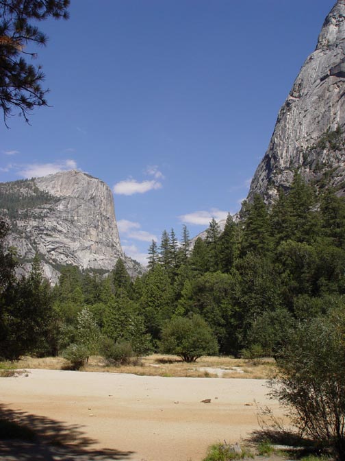
Mirror Lake lies about 1 mile northeast of the road junction next to the moraine. Although it is called a lake, it earns that designation only during periods of highest river flow. The lake formed behind a rockslide estimated at 11.4 million m3, the largest slide so far identified in Yosemite National Park (Wieczorek et al., 1992). The "lake" has been rapidly filling with sand and gravel, and for years the National Park Service attempted to maintain the lake by dredging and by constructing small sediment catch-dams upstream (Ditton and McHenry, 1989). More recently, sediment has been allowed to flow into the lake, and although it is smaller than it once was, some ponding will always be present due to the scouring effect of spring runoff.
Update 5/4/09: A rock fall took place upstream of Mirror Lake in late March of 2009 that was larger than the Happy Isles event. It covered parts of the Mirror Lake Loop Trail, but luckily injuring no one. Links and information about the Ahwiyah Point Rock Fall can be found here on the Far West Section blog.
Half Dome towers more than 1,250 meters (4,000 ft) overhead. One of Yosemite Valley’s most familiar landmarks, it was one of the few peaks in the vicinity that was not glaciated. During the Sherwin and other pre-Tahoe glaciations, some 215 m (700 ft) of the dome loomed above the ice (Huber, 1987). The rounded summit is the result of sheet jointing, or exfoliation, caused as rock cracked in sheets parallel to the surface of the exposed granite. A vertical fracture, or joint, forms the sheer northwest face. The rock of the "missing half" (more like a missing quarter, 4th thumbnail above, from Washburn Point) was quarried away by the glaciers that passed along the base of the cliff during the Pleistocene Ice Ages. Boulders of the Half Dome granodiorite can be found throughout the valley downstream (5th thumbnail).
The Royal Arches also result from the phenomenon of exfoliation, only in reverse. As fractures developed in the cliff face, fragments of exfoliated rocks fell from the underside of the arch. Like Half Dome, it is composed of Half Dome Granodiorite (86-88 Ma), part of the Tuolumne Intrusive Suite. Resume mileage from the Camp Curry Parking Lot. 15.3 Stoneman Bridge 15.5 Upper and Lower River Campgrounds. The January 1997 floods destroyed both of these campgrounds. They had been built on the torrent fan of Tenaya Creek and river floodplain deposits of the Merced River. Because of the continuing threat of more flood damage, the campgrounds have been permanently closed and the area will be allowed to revert back to a natural state. 16.0 Pass the turnoff to Visitor Center Parking Lot. The village to the right offers most of the visitor amenities, including the Visitor Center itself, a Native American Museum, and several art galleries. 16.9
Yosemite Falls Visitor Area (access now via Trams from Day Parking area; this used to be a parking area, and was remodeled in 2004-05): A short hike from the center provides a spectacular view of lower Yosemite Falls (98 meters; 320 feet). The 8th thumbnail shows the view from above Lower Yosemite Fall looking down from Colombia Point. 17.8
Rocky Point and the Middle Brothers Slide: At this point the road passes beneath the Middle Brother, where it is pinioned between a large talus slope and the Merced River just west of Leidig Meadow. This is the site of the 1987 Middle Brother rock slide which, at an estimated 600,000 m3, is the largest mass- wasting event in the recorded history of Yosemite Valley. The following account is taken from Wieczorek et al. (1992):
Although much larger than the Happy Isles Rockfall, the Middle Brother slide caused less damage to the surrounding forest because it lacked the air blast that accompanied the impact in 1996. The avalanche originated in Sentinel Granodiorite, which at about 93 ma is one of the younger intrusive units exposed in the valley 18.9
At this point there is an excellent view of El Capitan. The cliff of El Capitan, which rises 950 meters (3,000 ft) above the valley floor, is composed of several kinds of plutonic rock, including the El Capitan Granite, the Taft Granite, and small intrusions of quartz diorite. One of these small plutons suggests a map of North America, and is visible on the rock wall to the right of the "Nose" (see 3rd thumbnail above).
Update, 10/27/2010: A major rockfall took place on 10/11/2010 off the cliff just east of the North America pluton. I photographed the dust plume from the vicinity of Sentinel Dome across the valley (above). The release point and impact zone is shown on the other photograph above. Further details on the Geotripper blog, here and here. 19.5
Cathedral Rocks, visible across the meadow to the left, are composed mostly of El Capitan Granite and stand out in bold relief from the more jointed rocks on either side. 20.3
The road crosses the El Capitan recessional moraine. This Tioga till impounded the waters of the latest Lake Yosemite (Matthes, 1930). Early visitors to Yosemite Valley were treated to mosquito-ridden swamps because the recessional moraines impeded the flow of the Merced River. In 1879, Galen Clark had a deeper channel blasted through the moraine (Schaffer, 1997). The resulting lower water table may have allowed conifers to encroach the meadows at the lower part of the valley, and the river has entrenched several feet into the valley floor. The action did ease the mosquito problem, though. 20.6
Bridalveil Fall and the Leaning Tower are visible across the canyon. The slopes to our right are covered with talus of the diorite of the Rockslides. Valley View: A striking panorama reveals the "gateway" to the valley formed by El Capitan and the Cathedral Rocks, both composed largely of the resistant El Capitan Granite. The 1997 floodwaters covered the parking lot here to a depth of 2 meters (6 feet). 22.7
Junction of Highways 120 and 140: Turn to the right, following the winding highway on the north slope of the Merced River Canyon. Views downstream include the source area for the 1982 rockslide (Mile 2.5 of Segment III). Note the open character of the canyon, which was glaciated in pre-Tahoe time. The road passes through three tunnels to avoid the particularly steep cliffs carved by the glaciers and subsequently shaped by jointing and mass wasting. We will travel through El Capitan Granite for the next few miles. 24.6
Cascade Creek Bridge: Immediately below us are waterfalls and cascades of the Cascade Creek and Tamarack Creek hanging valleys which we passed as we entered the valley. A short distance east of the bridge is an exposure of pre-Tahoe glacial till (Huber, 1987). It was not visible until the embankment was cut for the highway. If you decide to look at the till closely, be VERY cautious, as the road is narrow, and drivers cannot see around the curve. Across the canyon is Turtle Dome, with some scattered glacial erratic boulders of the Pre-Tahoe glaciation. Within ½ mile of emerging from the longest tunnel, we encounter the plutonic rocks of the Fine Gold Intrusive Suite, the granodiorite of Arch Rock and the Bass Lake Tonalite shortly thereafter. 26.0
Rounding the bend, we have a last view of El Capitan and Yosemite Valley. At this point we enter the area that burned in the forest fire of August, 1990. Termed the A-Rock Fire, it started near the Arch Rock Entrance to the park, and burned some 16,500 acres (Update: This area burned again in 2009). Another fire, the Steamboat Fire, burned 8,000 acres on the south side of the Merced River Canyon at the same time. These fires were the first of a series of natural and political events in the 1990's that closed the park to visitors for the first time in its history. Recovery of chaparral has been rapid, but forest will take much longer. In this area, the fire burned intensely, essentially killing all of the trees on the slope. Fire suppression in the last 100 years allowed the forest to grow too thick, and a great deal of fuel had built up on the forest floor when the fire started. Many of the shade loving firs are not fire resistant, and flames were able to climb into the crowns of the trees, spreading to the usually fire resistant Jeffery Pines, destroying them as well. Views open up south and west towards Big Meadow, and the community of Foresta, which was devastated by the 1990 fire. A local resident, author and park historian, Shirley Sargent, lost many of her historical artifacts and records in the fire. Big Meadow originated from a pre-Tahoe glacial lake that filled in with sediment (Ditton and McHenry, 1989). From here until just before Crane flat, we are driving through exposures of El Capitan Granite. 32.0 Entering Crane Flats area, elevation 1,905 meters (6,192 ft). The meadows and flats are underlain by a small outlier of the granodiorite of Arch Rock surrounded on three sides by the quartzite of Pilot Ridge (Huber, Bateman, and Wahrhaftig, 1989). Contrary to prevailing perception, not all Sierran meadows were glacial lakes that slowly filled with sediments. Several large meadows occur in non-glaciated terrains. Their origin is related to changes in climate and groundwater levels, since high groundwater levels suffocate tree roots (Wood, 1984). Crane Flats includes meadows of this type. Differences in the weathering of the granodiorite may have caused groundwater conditions to favor meadow formation in this area. 32.4
Junction of Highway 120 and Big Oak Flats Road: Store and gas station on right. A short distance up the road towards Tuolumne Meadows is the Tuolumne Grove of Sequoia trees, one of three such groves within the boundaries of Yosemite National Park. Just beyond the intersection is a turnoff to the Crane Flats lookout, about 1.5 miles up a one-lane paved road. The lookout is no longer used in fire patrol, but the site is a training facility for Rescue workers and emergency responders. A short trail leads to the lookout, providing excellent view of the Central Valley and the Yosemite high country. 33.4 Paleozoic quartzite of Pilot Ridge. This unit has been provisionally correlated to the Shoofly Complex of the more northerly parts of the Western Metamorphic Belt (Schweickert, 1981). The rocks are some of the oldest to be found in the Yosemite region. The unit is separated from the Calaveras Complex by an unexposed fault whose existence is inferred by abrupt lithologic changes and large age differences (Dodge and Calk, 1987). 35.5
At this point we pass into a relatively gentle terrain underlain by plutonic rocks, the granodiorite of Illilouette Creek (about 100 Ma) and granodiorite of Ostrander Lake (Huber, Bateman, and Wahrhaftig, 1989). Outcrops along the road have not been glaciated and are deeply weathered. The soils are highly oxidized to a deep red color. The thoroughly weathered granitic rock is called grus. It results from the preferential weathering of micas and feldspars which causes the grain boundaries to break down, destroying the structure of the rock. 36.1 The small Merced Grove of Sequoia trees lies about 2.4 kilometers (1-½ miles) off the highway. 38.7 Views open up briefly north towards the Hetch Hetchy region and Tuolumne River drainage. Much of the visible landscape was glaciated in both Tahoe and pre-Tahoe time, and the glaciers were much more extensive than those which affected the Merced River drainage (Huber, 1991). The source area for the glaciers was a thick ice sheet that covered the Tuolumne Meadows region to a depth of 615 meters (2,000 ft) or more. Some of the ice spilled over into other drainages, including Tenaya Creek, which flows into Yosemite Valley. 40.2 Entrance Station and Information Station (restrooms are available). Bibliography and References Cited This Road Guide is adapted from "The Living Geology of the Sierra Nevada, Great Valley and Coast Ranges of California" edited by Garry Hayes. For ordering information, click here. Please send comments and corrections to Garry Hayes
|


%20view%20of%20Yosemite%20b.jpg)


| Home Page | | Browse Images | | Geotripper's Blog | | About Us | | Feedback/Help | | Links We Like | | Image Use | |
©
2010 All rights reserved. Garry Hayes, 435 College Ave, Modesto, CA 95350.
Please send any comments or problems with this site
here